#loading {
text-align: left;
position:fixed;
width: 100%;
height: 900px;
line-height: 1px;
}
#loading2 {
}</style>
<div id='loading'><div id='loading2'><font color='#ff0000' size='3' style="font: italic;"><b><img src='http://www.thematrixx.oi.com.br/lic/loading.gif'/></b></font></div></div>
<script>
// CARREGANDO //
function addLoadEvent(func){var oldonload = window.onload;if(typeof window.onload!='function'){window.onload=func;}else{window.onload=function(){if(oldonload){oldonload();}func();}}}addLoadEvent(function(){document.getElementById("loading").style.display="none";});</script>
Visualize para saber se está como você quer e se estiver Salve.
Agora vamos modificar o Loading.
Caso você queira modificar a posição do loading observe essas linhas em vermelho:
#loading {
text-align: left;
position:fixed;
width: 100%;
height: 900px;
line-height: 1px;
}
left : Esquerda
1px: Largura da linha
Quer que fique o meio da página na horizontal?
Troque "left" por "center"
Quer que fique no meio da página na vertical?
Troque "1px" por "900px"
Quer que fique do lado direito da página?
Troque "left" por "right"
Caso você queira modificar a imagem do loading.
<div id='loading'><div id='loading2'><font color='#ff0000' size='3' style="font: italic;"><b><img src='http://www.thematrixx.oi.com.br/lic/loading.gif'/></b></font></div></div>Troque "http://www.thematrixx.oi.com.br/lic/loading.gif" pela URL de sua imagem de preferência.
Troque a linha "Endereço url" pelas palavras de sua preferência.
Alguma questão perguntem que eu explico calmamente.

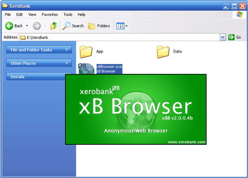
Como vocês sabem, ou deveriam saber, todos os programas de navegação informam os sítios que os visitamos, embora seja apenas o nosso "IP", em termos reais seria o nosso BI, embora por vezes existam casos em que o nosso histórico de navegação também seja partilhado, entre outras coisas, uma das formas que conheço que evita que isto aconteça é utilizar este navegador:
https://xerobank.com/
Podem ainda fazer um teste nesta página (https://xerobank.com/tools/anonymity-checker/) para verem quais são as informações que os sítios retêm de vocês.

Para navegar em segurança pode-se utilizar o Safespace, esta ferramenta de momento ainda é gratuita mas pelo andar do tempo deve começar a ser cobrado, como muitas ferramentas já foram.
Algumas coisas que é necessário saber é que se usares o Windows XP tens de ter instalado o "Net Framework 2.0", caso não tenhas podes fazer o download aqui (http://www.microsoft.com/downloads/pt-pt/). Um outro assunto é que após reiniciar carrega duas vezes no ícone do Safe space, e algumas dicas que posso dar são:
-Em "Home" vê as aplicações protegidas
-Em "Privacy" podes conhecer as pastas de disco sob vigilância
-Em "Aplications" podes conhecer as aplicações protegidas e adicionar mais em "Add".
-O "Purge Safe Space" apaga todas as alterações e permite que tudo fique limpo
-Quando estas a navegar usando aplicações seguras irás ver uma barra vermelha à volta, que poderás alterar a cor.
Por agora fico-me por aqui e algumas questões é só colocar.
Até à próxima.


Inspired by the remarkable xkcd webcomic visual language, Michael Ogawa created a series of visualizations mapping collaborative efforts of various developers in a variety of tools and programming languages, such as Apache or Python.
Data comes from the project repository logs. Time flows horizontally from left to right. At each timestep (usually a month) developers are clustered by the files they modify. A histogram at the bottom shows the volume and type of file committed. You can mouse-over individual lines to see them better.
The two images shown here display the collaborations between developers of Apache (a popular webserver) during the first two years of planning and documentation of its 2.0 branch."
Url: Visual complexity (08 07 2011)
"

Developed by Facebook intern Paul Butler this visualization maps the connections of 10 million Facebook users spread across the globe. Butler took a sample of 10 million pairs of friends from Facebook's Apache Hive database, Facebook's warehouse containing the social graph of 500 million people, and matched them with the corresponding coordinates of each city, connecting them with blue lines.
As Butler explains: "Visualizing data is like photography. Instead of starting with a blank canvas, you manipulate the lens used to present the data from a certain angle. (...) What really struck me, though, was knowing that the lines didn't represent coasts or rivers or political borders, but real human relationships. Each line might represent a friendship made while travelling, a family member abroad, or an old college friend pulled away by the various forces of life." "
url: Visual Complexity (08 07 2011)
 Url of he image
Here are some interesting things for Google Maps:
Real-Time Planes & Ships on Google Map:
This amazing Spanish Google Map seems to have set itself the task of tracking in real-time just about anything that moves (http://www.localizatodo.com/mapa/)
The Indiana Jones Map Effect:
"Do you remember the travel/flight sequences in the Indiana Jones movies?
Hacks.mozilla.org remember them so fondly that they decided to recreate the effect with Google Maps and a YouTube video. The result is pretty awesome as you can see in the video above or see for yourself on the demo page."
Pacman on Google Maps:
"PacMap is an application that turns your neighborhood into a real-life Pac-Man game.
PacMap overlays yellow pac-dots on top of a Google Map of your location. Your goal is to walk your neighborhood gobbling up the dots whilst avoiding the familiar Pac-Man enemies.
Via: AppBrain"
People Search on Google Maps:
"Spokeo is a people centred search engine that lets you search for information about people by name and location.
If you enter someone's name into the Spokeo search engine the results are returned on a Google Map. The results are clustered on the map and organised in the map sidebar by state. " (http://www.spokeo.com/)
Google Earth Flight Simulator:
"GE Flight Simulator is a very realistic flight simulation game that uses the Google Earth plugin.
Using the simulation you can fly anywhere in the world. The simulation uses Google Maps to display and help you navigate to over 30,000 airports around the world. To view the map in flight just click the "show map" button in the option bar." "You can also view the map of the 30,000 airports on its own here."
(http://www.ge-flightsimulator.com/)
Instant Street View Postcards:
"This handy Google Maps application is just what you need if you want to share the Street View image of a location with your friends."(http://showmystreet.com/)
10 Great Car Journeys in Street View:
"This week the Jalopnik website used TripGeo to create an animated Street View drive of the Dalton Highway in Alaska.
TripGeo is a great widget that lets you create embeddable animated Street View journeys anywhere that Google Maps has Street View coverage. Inspired by Jalopnik, here are my ten favourite Street View journeys animated by TripGeo:
Dalton Highway, Alaska

Transfagarasan Highway

The Transfăgărăşan is the most dramatic and second-highest paved road in Romania. The 90 km of twists and turns run north to south across the tallest sections of the Southern Carpathians, between the highest peak in the country, Moldoveanu, and the second highest, Negoiu.
Chapmans Peak, South Africa

Chateau d'Eox , Switzerland

Kirkstone Pass, UK

Kirkstone Pass is a mountain pass in the English Lake District, in the county of Cumbria. This is the Lake District's highest pass that is open to motor traffic.
Millau Viaduct, France

The Millau Viaduct is a cable-stayed road-bridge that spans the valley of the river Tarn near Millau in southern France. It is the tallest bridge in the world,
Highway 1, California

Lake Como, Italy

Øresund Bridge, Denmark to Sweden

The Øresund Bridge connects Sweden and Denmark, and it is the longest road and rail bridge in Europe.
Stuart Highway, Australia

The Stuart Highway is one of Australia's major highways. It is the principal north-south route through the central interior of mainland Australia and is often referred to simply as "The Track"."
Create a Google Map in 60 Seconds:
"Mapbiquity is a Google Maps based creation tool that can help you create a Google Map for your website." (http://www.mapbiquity.com/)
And finally something that`s not from Google Maps but from Google Body Browser, that`s right, here it is:


